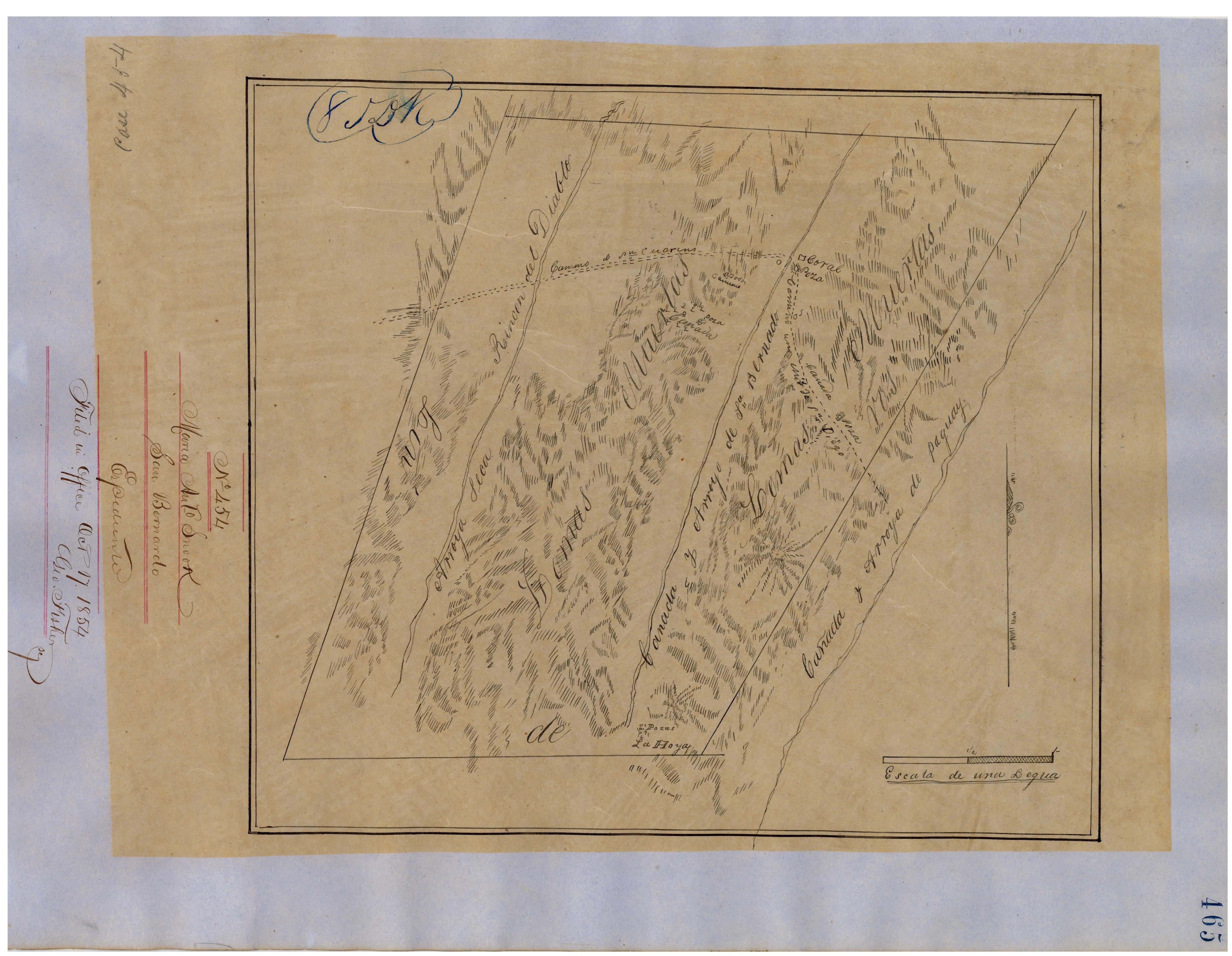
The map below provides a general outline of the Rancho San Bernardo in 1854. It is not a precise rendition of the mountains, waterways, and roads. Those features seem to be included as a general reference, not a depiction of actual reality.
Notes:
Canada y Arroyo de Paguay = Valley and creek of Paguay [Pauwai, Poway], defined by today's Poway road and creek.
Canada y Arroyo de San Bernardo = Valley and creek of San Bernardo, today's San Dieguito river.
Arroyo Seca = dry creek
Rincon del Diablo = [Rancho of] the Devil's Corner, today Escondido
La Hoya = pit or hole
Poza/Pozas = pool or pools of water, perhaps a spring
Lomas Muertas = Dead Hills; this refers to grasslands where trees are virtually absent, today classified as 'coastal prairie'
Camino un [?] de San Diego = Road to San Diego*
Camino de C[?] San Marcus = Road to [Rancho Vallecitos de] San Marcos, and on to Mission San Luis Rey**
* Cart road used by the Spanish and Mexicans linking a number of Ranchos, including San Bernardo, El Rincon Del Diablo, Santa Maria, Santa Ysabel, Valle de San Jose and San Felipe, with the port of San Diego
** not shown is the road branching off at San Bernardo, going east through the Kumeyaay pueblo of San Pasqual and Rancho Santa Maria (Ramona)